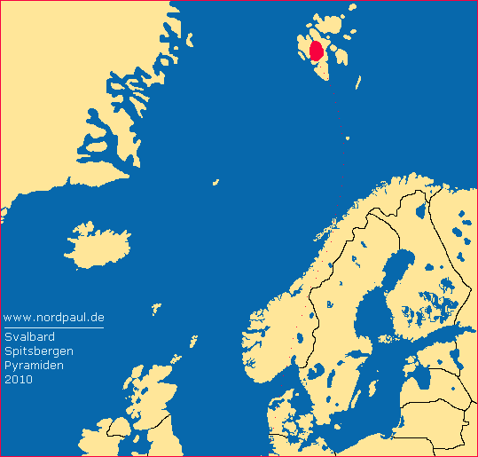
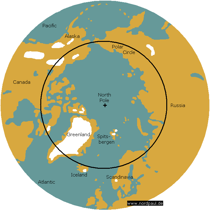
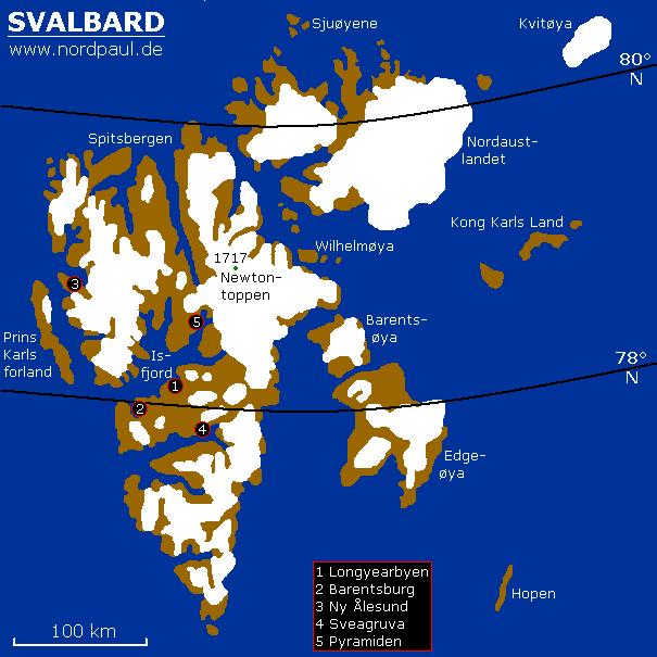
Svalbard around to Pyramiden 2010
In 2008 I had written on my website on nordpaul.de: "The archipelago Svalbard: former home of polar explorers, adventurers and discoverers. Far away from Central Europe. It was merely a dream. In my youth, I only read about Spitsbergen. In August 2008 I was there for twelve days and twelve bright nights." Now I can add with even greater joy: In August 2010 I was back in Svalbard. This time for 17 days - with nearly precipitation-free weather.
On my arrival at the Norwegian main settlement on Svalbard, Longyearbyen, I am greeted with undisturbed, bright sunshine. My tent is set up quickly at the campsite near the airport. Then I'm walking the usual one hour journey on foot into Longyearbyen to the COOP Svalbard where I can buy all the necessary food and supplies for the following days in absolute wilderness. These supplies include pasta, cracker bread, and jam in a tube (22,- Norwegian Crowns, exchange rate in 2010 was 8,- NOK = 1 €). The large propane gas cartridge (80,-) for my Primus stove must not be forgotten.
During my visit to town, I relish some delicious pastries: Skolebrød (16,-) and baked bread with cheese (16,-). The next day I visit the former coal mine Gruve 2b; which is located on the western hillside of the Longyeardal. The sun is shining and under the blue Arctic sky it is a mild 6 degrees Celsius, nevertheless, the old mine entrance is completely frozen.
 |
 |
 |
 |
| Isfjord |
Gruve 2b |
Longyeardal |
summer ice |
In the next few days I meet the other three participants of the international expedition. Some of the logistics must still be organised; borrowing two rifles, for example, adequately prepares us for the possibility of coming into contact with Polar Bears.
On short hikes we see the surroundings of Longyearbyen; fossils are found in abundance at the glacier edge and we see the tracks of an arctic fox. In the evening, our team dines out in a local restaurant; I have pizza (140,-) and a pear cider (40,-) as the last refreshment before the big adventure. The midnight sun and the never-ending light is lifting the mood higher and higher and the 10 degrees Celsius in August(!) is not as cold as you imagine.
 |
 |
 |
 |
 |
| fossils |
arctic fox track |
Longyeardal |
cable way |
almost 12 PM |
Early the next day we finally start our adventure on the ship MS Polargirl (750,- one way) to the abandoned Soviet ghost town of Pyramiden. Once, it was a mining village with over 1,000 permanent inhabitants; like the still inhabited Russian town of Barentsburg. However, Pyramiden was abandoned in 2000. Today in the summer months a small group of construction workers from Barentsburg work to save the buildings from severe flood damage.
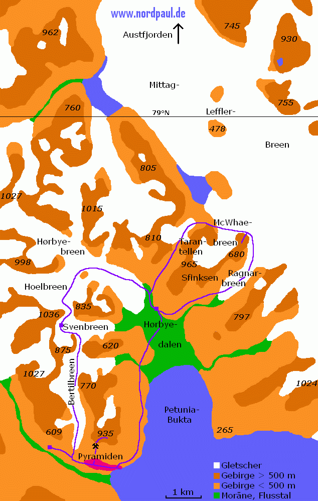
I am familiar with Pyramiden from my trip in 2008. This time, we are also walking and climbing up the spectacular mountain that gave this town its name. An enclosed coal-truck railway leads us up the side of the mountain to the mine entrance at around 400 m. There it looks a bit untidy due to landslides. From the mine we walk further up the steep rocky mountain. The terrain is primarily loose scree composed of rocks varying in size, offering little support when walking. The summit of Pyramiden is 935 m high. We climb to an altitude of 850m but can go no further due to steep scree and mountain top cliffs. The view is amazing and my eyes wander very far toward distant peaks.
 |
 |
 |
 |
 |
 |
| Skansebukta |
bloom |
Pyramiden |
sports |
transport |
mine railway |
 |
 |
 |
 |
 |
| hillside mine |
parabolic mirror |
gravel |
summit |
plateau |
Pyramiden is almost like a wilderness because there is nothing except a daily tourist ship visiting for two hours. But on the next day our real northern ice wilderness campaign will begin. We walk for two days on relatively flat glaciers. They have names like Bertilbreen, Svenbreen, Hoelbreen or Hørbyebreen. We climbed up and through several mountain passes over 600 m and negotiated our way down the steep sides into the next valley. On the first two days we tour for 16 km and 30 hours on glaciers. Of course we also have dinner on the glacier and we sleep on the ice, not far from the bergschrund, for one night.
 |
 |
 |
 |
 |
 |
| bear paw? |
Svenbreen |
ice camp |
Hoelbreen |
lake on ice |
crevasse |
We make our northernmost camp on a flat topped moraine in Hørbyedal for three days, this is our base camp for day tours. Essential for our safety is the polar bear protection every night: a fishing line is stretched in a little distance from the tents and at the end connected with some pots. If a polar bear - or any other creature - passes through the line, the pot tower will collapse with a lot of noise and we will hopefully wake up to react and chase away the bear. Fortunately, this does not happen.
 |
 |
 |
 |
 |
| bear protection |
Hørbyedalen |
sun summit |
camp |
Couscous |
The next day begins with the promise of travelling as far North on this planet as I have never before been. We travel over the glacier tongue of Ragnarbreen, and further up to the wide glacial area of Mittag-Lefflerbreen. To the west we see the spectacular summit Sfinksen with its height of 905 m. In front of us we see the short McWhaebreen and it is not long before we are crossing its ice.
From Tarantellenryggen we see north to Austfjord, which is the southern end of the Wijdefjord. Anyone who follows this fjord will find themselves, after a few hundred kilometers on the Polar Sea, directly at the North Pole. This is the northernmost point I have reached in my life. We have a spectacular view.
Later, we turn south and walk along the famous rock formation Tarantellen. After 17 km, 8 of them on glaciers, we are back to our tents. The next day very strong winds test the quality of the material and the stability of the tents. My Helsport tent withstands the tempest fantastically. Slowly, our trip turns back towards civilisation. To get back to Pyramiden we must cross an ice cold glacial river in bare feet which is accomplished without an accident.
 |
 |
 |
 |
 |
| Ragnarbreen |
glacier gap |
Wijdefjorden |
Lefflerbreen |
Sfinksen |
 |
 |
 |
 |
 |
| Tarantellen |
snowfield |
tent and storm |
Svenbrehøgda |
Nordenskiöldbre |
Back in Pyramiden we visit the village and the surrounding area a little more intense then before. The weather is still impressively well.
 |
 |
 |
 |
 |
 |
| map |
power plant |
Pyramiden |
sunbeam |
gravel track |
summer house |
The old coal power plant is situated near the harbor. We take some time to explore this (future?) Industrial Museum, I even climb one of the two chimneys half way to the top. Suddenly, the vessel scheduled to take us on the journey back to Longyearbyen arrives at the quay. One last goodbye to Pyramiden.
 |
 |
 |
| power plant |
meters |
on chimney |
For our return journey we travel on the ship MS Langøysund which is not as good as the superior MS Polargirl. First, we have a short stop at the mighty edge of the Nordenskiöldbre glacier. As our journey progresses down Bünsowland to the wide Isfjord the sea becomes rougher and rougher, forcing the boat to heave in the swell. I have never experienced a ship rocking around so much on the open water and lived to tell the tale.
After a very delicious buffet, full of Nordic delicacies, in the Radisson Blu-Hotel (325,-) we return to the campsite. The next morning brings the first snow of the fast approaching autumn to our tents; this was certainly a surprise to us all. It is time to say: bye bye Svalbard!
If you want you can correct my English because it is not my native language.
Just send me an e-mail: webmaster@nordpaul.de
 |
 |
 |
 |
 |
| glacier edge |
Bünsowland |
rough sea |
Adventfjord |
first snow |
» Links
Last modified: 2018/04/26
♥ Privacy means: no tracking, no cookies, no third-party ad servers or ad networks. ♥
© nordpaul.de - Pictures of Northern Europe
- nordpaul.de - North Europe - Site Terms - [deutsch] -
Svalbard Spitsbergen Longyearbyen Adventfjord mine glacier Pyramiden Nordenskjøldbreen Gruve 2b Skansebukta midnightsun plateau Svenbreen Hoelbreen Gletscherspalte polar bear Hørbyedal Ragnarbreen Austfjord Wijdefjord Mittag-Lefflerbreen Sfinksen Tarantellen fjord


